In an earlier post, I talked about how to use Automation Script to send an HTTP request by invoking a pre-configured End Point. That approach has some flexibility as we can override various properties during runtime like URL, Headers, or HTTP Method. Despite that, it is still quite limited and only suits simple scenarios.
In a recent task, I had to port an ArcGIS interface from Java to Autoscript. I improved the approach a little bit to address this real-world requirement. I document the simplified version here as it can be handy for me in the future. I hope that it is useful to some of you out there too.
Note: I use Webhook.site to test the code. It is free to use. If you like to test the code yourself, you will need to visit the site first to generate your own Webhook URL

Example 1: GET Request
I need to send a request to ArcGIS to get details of a Control Valve. It is a simple GET request with some parameters. Below is a basic example.
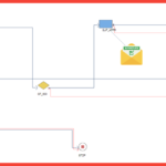
I created this as a script on the Asset Save launch point. It lets me to trigger the code easily by updating an asset record. When a request is sent to Webhook, it shows the request details including Parameters and Headers. Notice that in this case, it correctly decoded the basic authentication to a username/password pair for the MAXADMIN account.

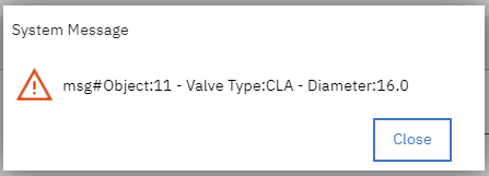
Now, if I update the URL to point to a sample ArcGIS online server as in the code below, I can retrieve the details of an asset.
Below is what we see in Maximo.
Example 2: POST request with form data
In this example, I want to send a Service Request to ArcGIS. To add or update a feature, we need to send a POST request and the content should be in form-data format. Below is a basic example. It includes building a JSON object, converting it to string, and then sending it in form-data format.
I created it as a script on the “Save” event of the “SR” object. In this initial version, we send it to Webhook first to ensure the request is formatted correctly. As shown in the screenshot below, the form data is read correctly.

Now to make it real, I updated the code to send it to ArcGIS online server. In this case, I hardcoded the coordinate value to the Naperville City Hall. Determining the X and Y coordinate of a Service Request based on Asset or Location is out-of-scope of this post.
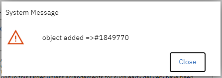
To trigger the script, I update a random Service Request in Maximo. If a new feature is created successfully, we will get a message with an Object ID as follows.
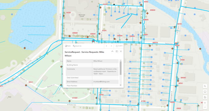
We can open ArcGIS Online map, zoom into the area near Naperville City Hall and we should be able to see the new SR as a green point on the map


")
")